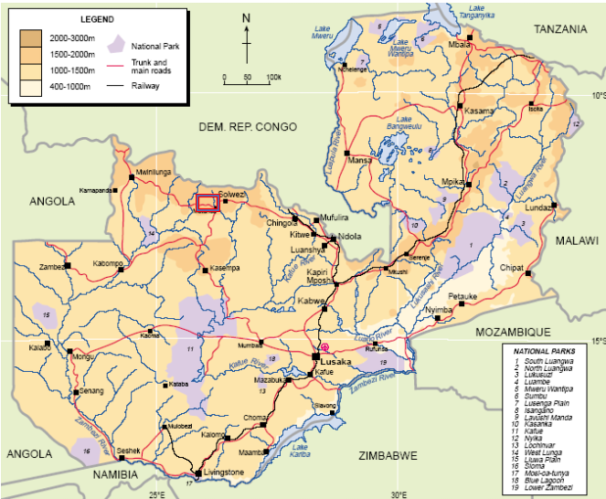
Rising Mines has License 24440-HQ-LEL in the Kapiri Mposhi District in Central Province within the Mulungushi Rock authority.
Mulungushi Rock Development
Mining site
The Prospecting licence occupies an area of 2387.5643 ha. The site lies about 26 Km southeast of Kabwe Town and 46km from Kapiri Mposhi Town in the Mulungushi Rock Authority area. The coordinates of the central location of the Prospecting licence are 14o13’39.5’’S and 28o25’19.4’’E or E653357 N8426739.
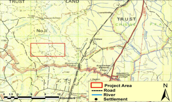
Prospect Area - Detail
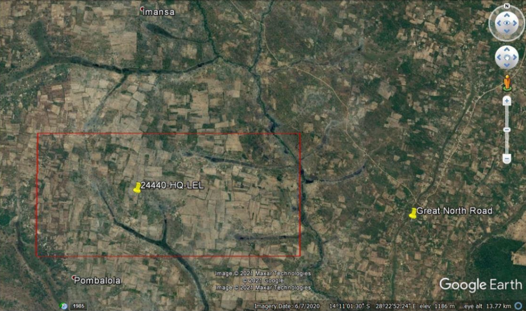
Prospect Area – Satellite Map
Regional Geological Outline
At regional level, the geology of the Kapiri Mposhi area belongs to the Copperbelt-type of mineralization, which is controlled by structural trends. The main geological structural trend that controls copper, gold, manganese and base metal mineralization in the north-western province and Copperbelt provinces of Zambia is referred to as the Lufilian arc, into which several sub-structures, called domes, are located. The mineralization for the project area within Kapiri Mposhi is largely determined by the Kalahari Group comprising of Katanga System and Basement Complex. The licence area is on the western flanks of the geological trends.
Historically, Kapiri Mposhi has been a prospective area for copper, gold, manganese, silver, iron, uranium, cobalt, manganese and gold mineralization as far back as the 1950s. Various international prospectors have traversed the area in search of mineral deposits.
Prospecting in Kapiri Mposhi and Surrounding Areas
The Kapiri Mposhi area is generally a flat land with average altitude of about 200-600 feet to rolling plains of about 1,200 meters above mean sea level. Firewood, clearing of land for cultivation and settlement in the area around the proposed project site means most if not all merchantable large trees have been cut down leaving shooting shrubs of the miombo wooddlands.
Pre-feasibility studies suggest a mining operation with significant output of copper and gold over a life of 20-30 years is achievable.